|
|
|
|
|
|
|
|
|
|
|
|
|
|
|
|
|
|
|
|
|


main record
|
REGIONS
OFFICIAL WEBSITE Official representative office of Leningrad Oblast
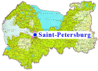
Leningrad Oblast enjoys a favorable geographical location in the north-west of the Russian Federation.
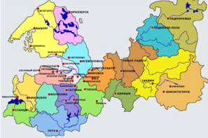
Since 1 January, 2006, there has been introduced a new administrative and territorial division of Leningrad Oblast: 17 municipal regions and 1 urban district constitute municipal areas of the second level, besides, 63 urban and 142 rural settlements, also on the territory of the region, represent the first municipal level.
Leningrad Oblast possesses considerable reserves of natural resources – timber and water resources, minerals, varied flora and fauna. Actively developed are resources of oil shale, bauxite, phosphorite, granite, limestone, sand; refractory, metallurgical, and cement clay; dolomite, quartzite, mineral paints, and so on. The industrial development of ferrimanganese burs in the Gulf of Finland has been started.
Due to its favorable geographical position at the intersection of water, air, and land communication lines, the region in recent years has turned into an implementation platform for some of the major trade and economic projects in Russia.
|
|
|
This project is funded by the EU |
A project implemented by Jyväskylä Regional Development Company Jykes Ltd |
|
|
|
The Web site has been produced with the assistance of the European Union. The contents of the Web site is the sole responsibility of implementing partner Jykes Oy and can in no way be taken to reflect the views of the European Union. |
||||


 About
56% of Leningrad Oblast territory is taken up by woods, 14% is
occupied by lakes, and 17% covered by marshland of different kinds.